

This is your community page where members can post ... anything!
Chaco Canyon, which is considered the most alluring of all archeological ruins in North America, and possibly the world. Considering some of the human intrigue that happened here before its abandonment, one might even say the most mysterious.
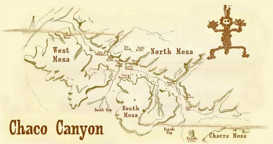
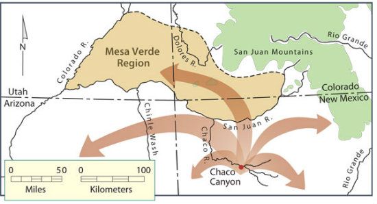
Location/Geography: In northwestern New Mexico, San Juan and McKinley counties. Closest town: Farmington or Aztec. Area: about 34,000 acres. Chaco Canyon lies entirely within the San Juan Basin and is surrounded by the Chuska Mountains in the west, the San Juan Mountains to the north, and the San Pedro Mountains in the east.
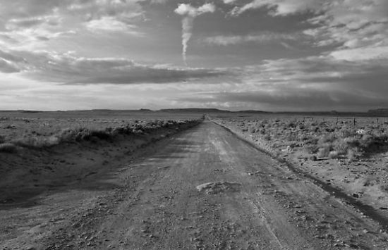
Spotlight (just the facts, ma’am): Chaco Cultural National Historic Park (hereafter, “Chaco Canyon” or “Chaco”) is an engaging and sui generis archeological ruins that has no parallel whatsoever to any other setting. Like a Mecca-shrine in its own right, only without a postulated prophet-oriented purpose, Chaco’s layout is deemed the most significant of all Ancestral Puebloan communities (a culture previously dubbed the “Anasazi,” though this moniker is no longer vogue or appropriate). To some Puebloans, particularly the Hopi Indians, Chaco remains a guarded secret. Solar/lunar alignment of its numerous structures typifies Chaco’s telling cosmological utility to the inhabitants. Hence, the magnitude of its archeoastronomy corollary to the cosmos. Some archeologists and anthropologists (hereafter, “cultural scientists”) equate Chaco Canyon to Arizona’s Casa Malpaís ruins, possibly even Colorado’s Chimney Rock archeological site, and specifically in view of the strong emphasis placed on observing changing seasons. Where these people built this literal shrine of the prehistoric ages, all roads led here. For modern day visitors, once leaving regional main highways the entry points (there are two) are unpaved. Driver are thus cautioned to slow down and ease back into another time frame from long, long ago. . .
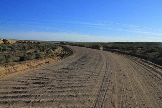
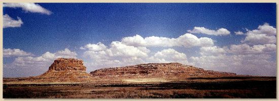
After a while the scenery changes, the elevation dips and what's ahead is a more promising view of Chaco Canyon's austere and engaging backdrop:
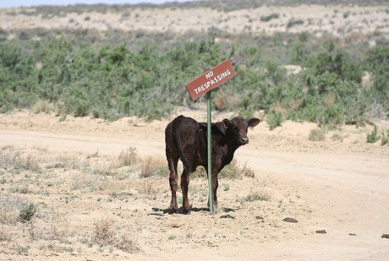
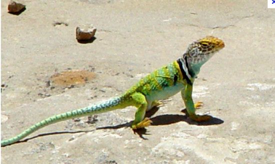
And if you feel like it, you can give one of these guys a lift. But don't hit 'em, because this is open range country and any livestock you run into (or they into you) means you have to pay the rancher. No kidding. . .
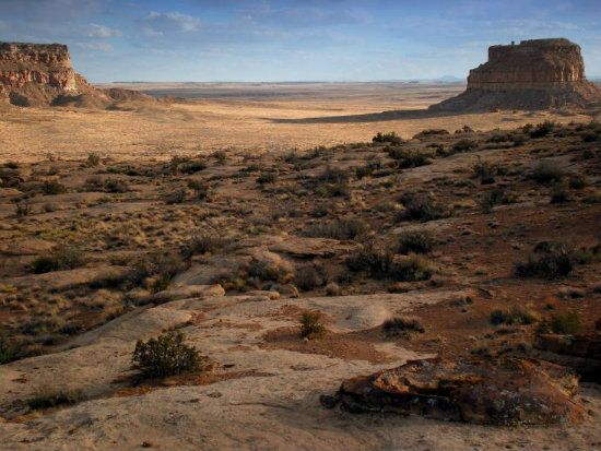
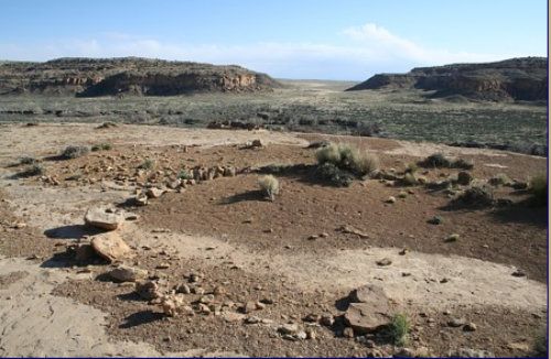
Snapshot (more details): Chaco Canyon is typically desiccated terrain. Its high desert setting denotes an isolated sector away from the more populous Ancestral Puebloan communities that once lived throughout the Four Corners regions, whose numbers may have been well over 100,000 strong just before their great diaspora off the Colorado Plateau in the late 13th Century.
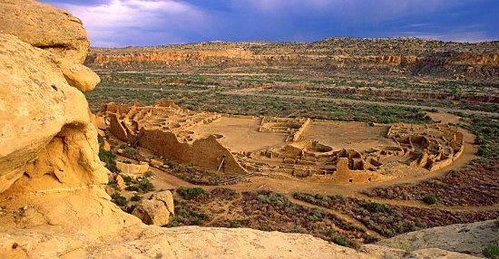
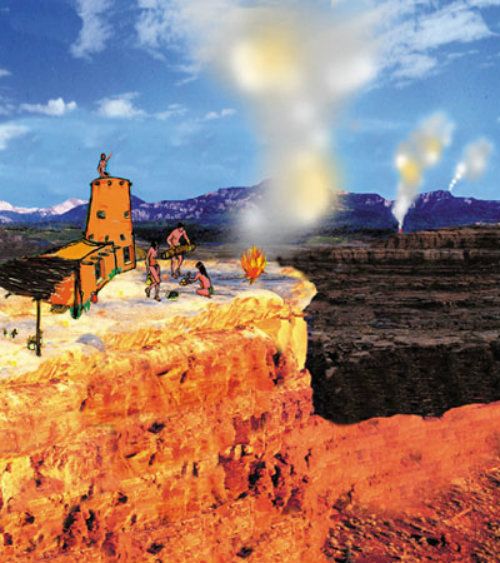
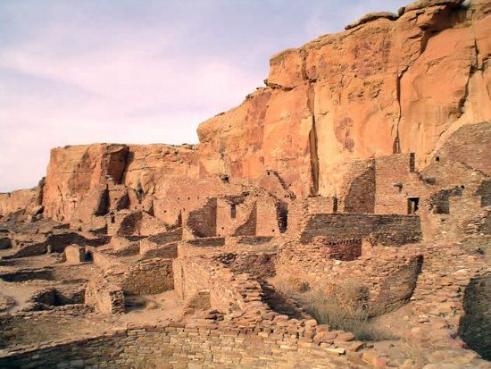
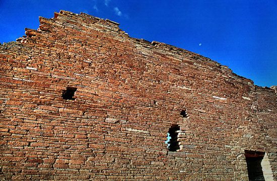
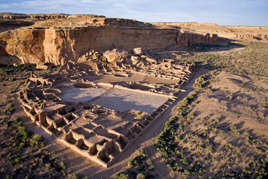
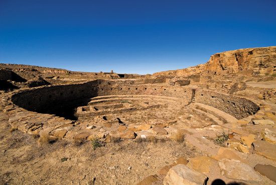
It is believed the numerous and so-called Great Houses built throughout Chaco’s compound were functional temples. Chacoans who came here, and perhaps an exclusive roster of people from select clan members, made annual pilgrimages for ceremonial purposes. From Farmington, New Mexico, on Hwy. 550, then to County Road 7900, travelers came from afar, each bearing a variety of acquired trade goods (as gifts), such as pottery and jewelry. Rimmed by mesas, Chaco is located within lowlands circumscribed by dune fields, ridges and a topography generally defined by a mountainous terrain. The broad layout of Chaco’s periphery generally follows a northwest-to-southwest axis. Home to the most exceptional concentration of archeological ruins in the Southwest, this site was designated a national monument in 1907. In 1980, an additional 13,000 acre allotment was added. The park is set in a secluded high elevation canyon carved by the Chaco Wash. With its assemblage of ancient ruins, Chaco is the foremost cultural and historic attraction of its kind. One glance at the Great Kiva of Chetro Ketl will suggest why many people, professional and laymen alike, consider Chaco the most important of all archeological ruins.
Remarkably, as much as is known about this visually arresting site, what some might dub a altogether mysterious setting and an equally mysterious human history motif, Chaco continues to generate its fair share of speculation. We know only that this assembly of singular structures was used during part of the year by the majority of Chaco’s inhabitants, most likely as a religious hub. Indeed, very little is understood about Chacoan ceremonies. Possibly, Chaco Canyon was similar in ways to other famous pilgrimage sites such as Mount Kailash in Tibet (an active site for the past 15,000 years). Designated a national historic park in 1980. Governing body: National Park Service.

Guided Tour Essentials (a more complete comprehension): Given Chaco Canyon’s geographic aspects, there are immense gaps between the southwestern cliff facades. Specifically, the numerous fingered-side canyons (commonly called rincons). The Chacoans made special use of these places, for they were critical in funneling rain-bearing storms into the canyon-like setting, thereby augmenting water resources. For obscure or clear reasons beyond archeological interest, especially the intrigue of its layout and numerous ruins, Chaco’s milieu may be the most important site of its kind in North America. Apart from the Ancestral Puebloans who came and went here over the centuries, many distant tribal people also visited Chaco, bringing with them offerings such as pottery, exotic birds, and jewels to mention some articles. From 900 to 1130, the Chacoan culture was nothing less than industrious; also, glorified. The inhabitants built multi-storied buildings and planed extensive roads throughout the 49,710 square miles encompassing the San Juan Basin that defines the overall topography of this region. Indeed, perfectly straight roads that originate in Chaco emanate out for many miles to other pueblo or so-called Great House sites. The question remains: Why build roads when these people had no carts, much less animals to pull them? Perhaps the answer lies in some religious significance rather than trade. Perhaps there's another riddle. Still, the network of roads Ancestral Puebloans cleared and fashioned led to this epicenter of culture and people came here by the thousands.
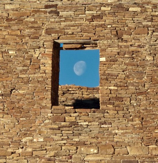
Another question often entertained when visiting this site concerns he original builders and dwellers. Namely, what were they thinking by aligning most of their structures to either solar or lunar light? Why was the alignment so important and so particular given the mathematics of design? Recently, some cultural scientists suggest that several of the large central buildings, especially the most famous, Pueblo Bonito, were used primarily for ceremony (though without saying exactly what kind of religious or spiritual ceremony). It follows how Chaco Canyon’s cultural center in the Southwest likely served as a ceremonial hub for outlying Chacoan communities. Astronomy, specifically the discipline of archeoastronomy, played a pivotal role in Chacoan culture, as realized from astute empirical observations of the heavens taken over many decades. Indeed, there is a special landmark close to their dwellings where trained observers, possibly shamans or the like, had marked the solstices, equinoxes, and solar noon, including so-called standstill positions of the moon revealed on thirteen light markings on petroglyphs (see below for a further explanation).

Incredibly, eleven of the major structures are directly oriented to either the sun and moon. Each major structure also has an internal geometry that corresponds to the relationships of the solar and lunar cycles. More astonishing, most major structures are oriented in a solar-and-lunar alignment. The aforementioned Pueblo Bonito, located at the approximate center of Chaco Canyon, plays the central role in this precise arrangement.
Latter Day Discovers: The ruins of Chaco Canyon were first discovered in 1849 by Lt. James Simpson, a member of the U. S. Army forces newly arrived in the New Mexico territory, also a member of the United States Topographical Engineers. He was assigned to the military governor Colonel John Washington. Washington’s goal was to contact the warring Navajos for the sake of obtaining a peace treaty, but it’s more likely he wanted to impress them with the military superiority of his expedition. Headed for Canyon de Chelly the expedition came across a fascinating landscape of well-preserved ruins (with much of the credit given to the typical aridity of the Colorado Plateau). This was Chaco Canyon and Col. Washington gave Simpson permission to examine the impressive landscape of multistoried ruins. Simpson's guide, Carravahal from the San Juan Pueblo, provided the name Pueblo Bonito, which is Spanish for “beautiful town.” At the conclusion of his expedition, Simpson published the first description of Chaco Canyon. Later, it was Richard Wetherill, a rancher and archeologist, along with George Pepper from the Museum of Natural History, who became the first to excavate at Pueblo Bonito. They started their excavations in 1896 and ended three years later. When they finished, Wetherill remained at Chaco Canyon running a trading post until he died in 1910. In the short period Wetherill and Pepper excavated, they had uncovered an amazing one hundred and ninety rooms, while photographing and mapping all of the major structures in Chaco Canyon. Wetherill and Pepper contributed immensely to the early excavation of Chaco Canyon. Naturally, precious archeological booty over the years was discovered. In some cases, artifacts were consigned to museums and sometimes sold for profiteering and private collections.
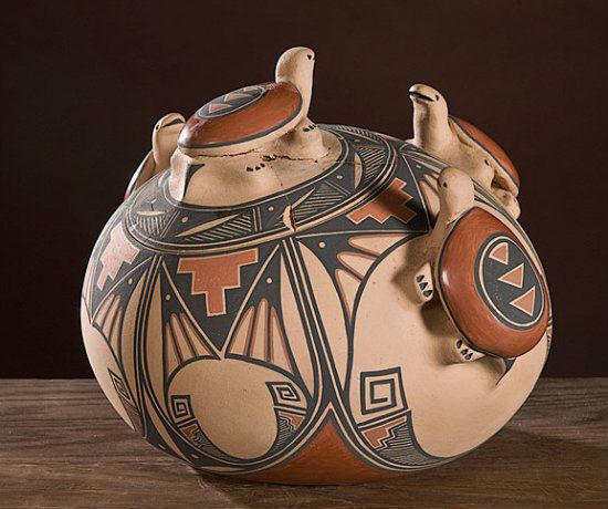
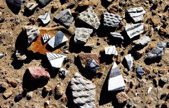
Those pieces that were not usurped by so-called thieves of time provide a window to the past revealing the artistry of the people who made numerous utilitarian and artistic vessels.

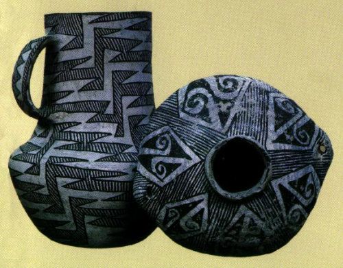
Also, considering how clay pottery was introduced to Ancestral Puebloan culture during the so-called Pueblo I Era (750 to 900), the amazing artistry of crafting pottery has grown ever since. Here's an example of a contemporary Puebloan design:
(FYI: Strangely, not too many skeletons were ever found here, leading some cultural scientists to view Chaco as opened to the people only during part of the year. According to one researcher (Craig Childs) 650 remains were found throughout the region, with 131 remains found at Pueblo Bonito (a relatively low number comparable to other archeological sites), all buried in two major tombs. The remains were stacked like firewood. Was Chaco considered another infamous massacre site compared to places like Cowboy Wash or Sand Canyon? Possibly.)
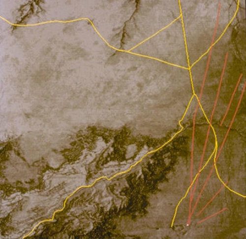
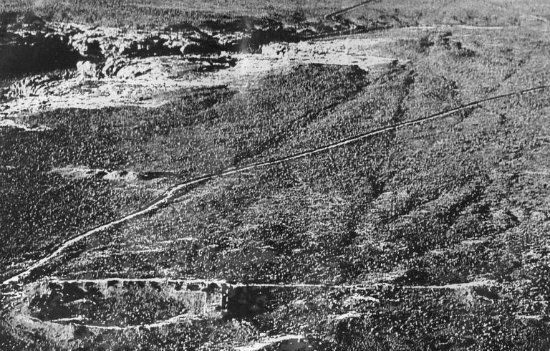
Radiating Roads From The Center: Ancient roads of amazing engineering feats to build them radiated from Chaco’s hub. The North Road among them seemingly vectored off into the distance, whose purpose has long intrigued cultural scientists. Perhaps it was a symbol of migration or direction representing death. From the air, these roads, most of them, are discernible. Still, the North Road and its purpose holds the interest of many cultural scientists. It is the only main road leading to and from Chaco, which is also part of a braid of thoroughfares inscribed in the desert scrub landscape, thus requiring more labor than building the dwellings at Chaco. Regardless what was in the way, the road builders of Chaco changed topographical features by continuing straight ahead, including building massive and impressive ramps or carving stairs up to summits of landmark features, then back down the other side. More than 100 miles of roads have thus far been documented throughout the region, with nearly 300 miles of partial roads still visible in some sectors. Some believe the roads actually extended much farther, say, over a thousand miles, heading this or that way, and always in a straight line. Still, it was the North Road considered to be the most complicated and longest, which stretched more than 50 miles from Pueblo Alto (which is one of the many Great Houses) to the San Juan River.
The Unknown Factors Of Chaco’s Network Of Roads: Cultural scientists have long pondered and debated Chaco Canyon’s vast network of roads. For instance, was there a special ceremonial endorsement associated with the North Road or any other similar pathway leading to or from Chaco? Was there a direct connection from one settlement to the other, depending on which road was followed? Averaging 30 to 40 feet wide, what was the purpose for such width? Were some or all of the roads intended as trading routes? Perhaps some were even used for moving goods? In one sector of the North Road, there are four or six other regional roads running abreast––why? Was it more than a utilitarian road plan for the Chacoan people? Perhaps something symbolic? To address the previous thought about Chaco’s straight road designs, according to some theories these people needed to be seen from great places. Winding roads would have therefore meant being more invisible in a mostly flat and unbroken terrain such as this region affords. Seeing farther also highlights a certain psychological advance, suggesting a sense of security. By constructing locales that afforded a greater perspective of the distances, people go more easily travel from place to place without getting lost. Indeed, the precise linking factor of sites for navigating was possible, regardless any landmark blocking the way. Thus a pragmatic and georitual landscape was created.
The North Road overview (the longer outline):
Presented with the unique layout of Chaco’s roads radiating from the center it likely was a way of inscribing the Ancestral Puebloan minds onto the landscape itself. The way these people planned their settlements and built their monuments that lined up in a precise way does indeed mesh with the topographical features throughout this overall setting. For instance, consider another Great House of Chaco, Casa Rinconada. Lines radiating from this dwelling pass directly through a number of other Great Houses, including penetrating through the centers of some of the larger kivas, thereby connecting to significant landmarks in the great distance. This design is not merely coincidental. Flawless symmetrical angles and intersections were computed (added together) to the finest detail. Surveyors, as well as priests, were part of the planning; they designed the roads and structures, most likely assisted by arco astronomers who formulated a map of the cosmos overhead. Combined, these specialists in the community created the initial outline and floor plan that enabled people to accurately move along preexisting terrestrial lanes of travel. Such travel could be accomplished during time of drought, and probably without causing territorial disputes with other tribal people. These roads were thus used as convenient maps for people to follow in times of need as well as for pilgrimage.
One other notable aspect of the people utilizing the terrain, especially higher places, was for signaling. One settlement could easily stay in touch with a more distant settlement, especially to warn others of imminent danger. This was a way to let other Ancestral Puebloan communities know they were not alone. Settlements flickering to life as fires burned in the night compensated for both darkness and the distance. Most of the sites were located on average 20 to 30 miles apart. The sites were therefore a convenient network for conveying information, linking one settlement with the next in line. Even during the day it was possible to send signals that could easily be seen. This means was accomplished by knapping obsidian (volcanic glass) that flashed in the sun. Perhaps pyrite mirrors (a/k/a “fool’s gold”) were also used.
Given such broad dimensions of nocturnal open space. . .

Ancestral Puebloan sentinels were able to connect with outlying communities by doing this. . .
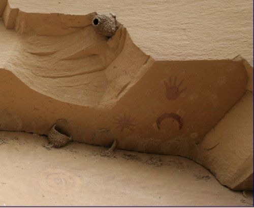
The Real Significance Of Chaco Canyon––Its Deign: The noteworthy aspect of Chaco's design is twofold. First, the elaborate architecture that has withstood the test of time for many centuries. Every slab of rock has been quarried and assembled, as though these builders were read from a master architect's blueprints such as is common today. Yet these people had no blueprints; they had no writing; no numbers. They had only pictographs for images left behind for others to see. But someone guided these people to build their dwellings with such preciseness and perfect solar or lunar alignment. There was indeed purpose in everything these people did.
Principles Of Archaeoastronomy: The other important aspect of Chaco's dwellings refers to the precise alignment of most of its structures. The alignment also directly relates to archaeoastronomy. Such scientific knowledge required generations of astronomical observations to skillfully and meticulously coordinate each building's construction so that it aligned with the cosmos. But where did the mathematics originate that made this possible? Some cultural scientists surmise the high degree of mathematics came from the Mayan civilization. And there are some diehard X filers who hold out for extraterrestrial schooling. But the Ancestral Puebloans were an intelligent and innovative culture that likely tapped into what humankind has always tapped into for creative genius: something abstruse from within.
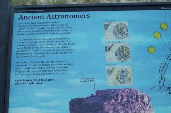
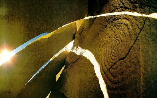
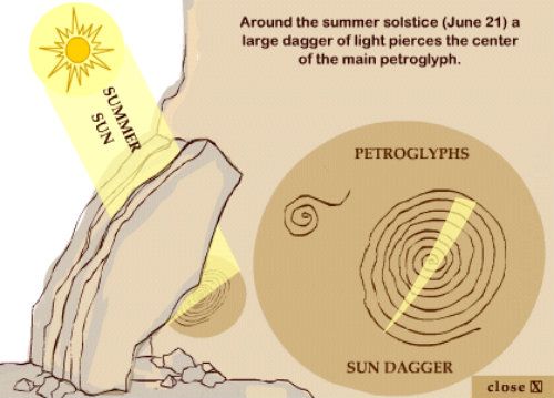
Other than the flawless design of Chaco's solar and lunar-aligned dwellings, all of which is predicated on archaeoastronomy, further evidence for this empirically-based science is the famous Sun Dagger petroglyph at Fajada Butte, a prominent site rising above the canyon floor (see below). The main complexes at Chaco are Pueblo Bonito, Neuvo Alto and Kin Kletso, all of which played a vital role in Chacoan belief systems. Visitors and scholars alike agree that Chaco represents the most interesting of all archeological ruins in the Southwest. Some might even suggest the most interesting site on the planet. Certainly, the abundance of curious and functional rock art keeps one speculating about the reason this unparalleled site was built, then later abandoned. In the wake of their departure, some of the structures that were partially destroyed by the very people who built and designed this ostensible religious center in a typically dry and sandy location here in northwest New Mexico.
Chaco Canyon is probably the best example of any archaeoastronomy site on the planet. Its science involves archeological aspects, as well as stellar observations. Apart from Chaco Canyon, Colorado’s Chimney Rock, and Arizona’s Petrified National Forest are some of the more notable archeological sites where such incisive observations took place.
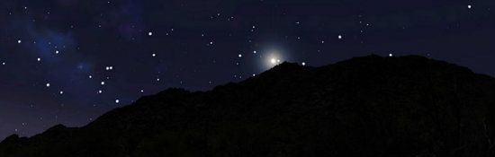
Today's means of star gazing:
While for Ancestral Puebloans their predictive means was by way of the naked eye:
Specifically, tracking a precise sun ray on a precise glyph:
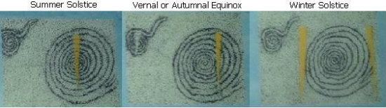
While achieving this verification without guessing:
In the archives of archeology, archaeoastronomy is a fairly recent contributor to a science-based disciplined by means of precise observations, both solar and lunar. Originating as pagan holidays in some parts of the world, archeoastronomy survives in modern times as neopagan holidays. Those who study archeoastronomy consider all its aspects worthy and telling in both a predictive and historical sense. Relative to the above mentioned sites (among some few notable others), what we have learned about the Ancestral Puebloans thought processes has contributed invaluable cultural information, particularly in their calculating annual solstice and equinox events. These observations include intervals of cross quarters (a cross-quarter day falls approximately halfway between a solstice and an equinox).
That famous glyph and dagger also was ensconced in this world famous Chaco landmark, called Fajada Butte"

Archaeoastronomy draws on several scientific disciplines for its knowledge banks. Primarily, disciplines related to astronomy, archaeology, anthropology, psychology and epigraphy (the decoding of ancient inscriptions). As for astrology, this, too, was important in adding to the storehouse of archeoastronomy’s knowledge. Its discipline, although not scientifically-based compared to astronomy, was nonetheless integral to humankind centuries ago. That’s because myth was as dominant in ancient times as mass media is today. For many people, astrology continues to hold fascination because the planets, sun and moon have always held sway with some people’s minds and imaginations. To be sure, its many facets of study and interpretations poses a wide appeal to cultures, race, even religion. However, the subject of archeoastronomy treated in this theme supplement will focus solely on this discipline, while also admitting astrology somehow, and in some way, managed to interphase with its science. Chaco Canyon’s significance is also touted in the following exposition.
Prehistoric Human History: Somewhere between 900 and 1150, Chaco was a major focal point of culture for the Ancestral Puebloans. They came here for a specific reason. Most likely, a ceremonial center. The layout of the dwellings certainly attests to a special relationship of the temporal with the eternal, namely an interest in the cosmos by predictive means (the solstices and equinoxes). The innate purpose for a massive complex distant from populated hubs, such as today’s Canyons of the Ancients (near Cortez, Colorado) or Mesa Verde, was to establish an archeoastronomy nucleus that was compatible with Chacoan religious beliefs. It's also assumed that the Mesoamerican Mayan and/or Aztec culture had influence on the Chacoans; certainly the similarities of construction and the advanced mathematics to conceive such building plans has ties with (especially) the Mayans. Perhaps such influence also stems from the urbanism of both the Mayans or Aztecs, particularly favoring a precision for predicting equinox and solstice events. It is assumed by many cultural scientists, even most Puebloans, how there's a likely crossover of religious beliefs and attitudes that may have struck a cord with the Chacoans. Without doubt, the Mayan polity, as a small hierarchical state, may have suggested a model similar to that of the Chacoans. Apart from such persuasive cultural modeling, the Chacoans did not merely imitate and build obvious pyramidal structures as the Mayans were especially noted for. Instead, they quarried sandstone blocks and hauled, or most likely rolled, these heavy stones in place and built the great structures of this epic cultural axis point. They also harvested timber from afar, assembling fifteen major complexes in Chaco Canyon, all similar to building designs of most other structures from this era. These utter and intriguing masterpieces of architecture would also become the largest building structures in North America until the 19th Century.
An Ancestral Puebloan Four Corners migration pattern:
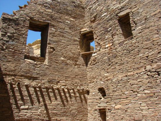
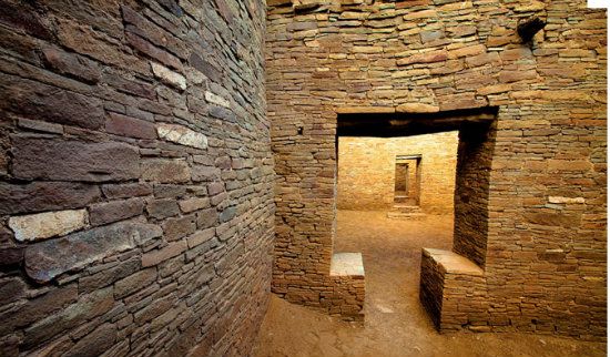
Innovated Building Design: Although there is no archeological evidence that clan systems ever existed during the Ancestral Puebloan’s occupation of the Four Corners region, cultural scientists have discerned enough from Chaco and its construction to lead some to believe clans were in fact assembled here. Principally, these would be the Scarlet (or "Parrot") and Kachina clans that are preserved today in the Hopi society. Whoever were the major overseers of Chaco's development, clans or otherwise, they used innovative masonry techniques for the construction of the multiple-story pueblos and Great Houses. Pueblo Bonito, the largest of these stupendous Great House structures, had over six hundred rooms and forty kivas, typifying Chaco's significance as a major ceremonial center. Building pueblo structures, especially the Great Houses, took many decades of coordinated effort to complete. Indeed, the design demonstrates a deeper understanding of the natural cycles of the Earth and its relationship to the cosmos. Many other examples of astronomical knowledge have been found in Chaco Canyon. But its layout of perfectly aligned structures is really the clue why these castles in the desert were built.

Consider, also the back wall of Pueblo Bonito is aligned on a perfect east-west axis. The precise alignment means on the Summer Solstice(June 21 or June 22), the sun passes directly over this wall.
Near the summit of Fajada Butte a crack in the rock wall is aligned with a spiral petroglyph, so that sunlight shining through the narrow opening of the this chink is perfectly centered during the moment of the solstice. Sunlight penetrating a window in nearby Pueblo Bonito also perfectly aligns with an inside corner of the building, but only during the Winter Solstice. Additionally, several petroglyphs have been found depicting astronomical events, such as the great supernova of 1054 (see below for more clarification). It’s amazing to think someone first had to notice the clockworks of the universe, as viewed from Fajada Butte, then upon computing the evidence by keen observation over the decades, build Pueblo Bonito in such a way to confirm the great celestial event, if a confirmation. It also boggles the mind the inspiration and ingenuity behind this affair.
Although Chacoan culture flourished for some four hundred years, and possibly a great deal longer, the Ancestral Puebloans left the region toward the end of the 13th Century (around 1251 and possibly as late as 1287). Several causes may have contributed to this mass emigration (a diaspora by any other name). However, the reasons why these people abandoned this thoroughly distinctive settlement remains one of the great mysteries of archeology. The same applies for why the Ancestral Puebloans departed from their homeland after having successful sustained their existence here for well over one thousand years. Nevertheless, evidence of an extended drought suggests a reasonable cause that initiated a restive cultural mindset, by which all else followed.
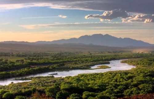
Thus a tradeoff for this typical Chaco desert terrain scene (then and now):
For a new country, like this (New Mexico's Rio Grande Valley):
There is also a matching theory that the Chacoans left elsewhere for a wetter climate, which is largely accepted by cultural scientists. Another theory, however, has something to do with religion but does not adequately explain what those religious concerns were. There may even have occurred a simmering social disorder or disagreement among the people (or various clans in the Ancestral Puebloan community) that finally broke out. Perhaps, too, an infectious and fatal disease had spread, including poor nutrition and iron deficiency causing anemia. Certainly, in view of some human remains of mostly women and children found at some of the ruins, a malady of some kind may have triggered a hasty departure. Cannibalism is thus sometimes suggested, though this often contentious subject (as Puebloans see the matter) is seldom mentioned by most cultural scientists, especially the park service that oversee many archeological sites throughout the Southwest.
(FYI: Even after Chaco was fully abandoned by the 13th Century there was a later revival of sorts, for people came here to repair some of the dwellings (Pueblo Bonito for one example). Then these people moved on again. Not until the 19th Century does activity resume again, which happened when Chaco was rediscovered, first by the Navajos, or perhaps initially it was the Hopis, then later archeologists.)
If you plan to visit here, and if you happen to see what appears like freebie artifacts on the ground. . .
It's bad form and bad juju to pocket any archeological artifact, even seeming throwaway stuff from the past. If you do get tempted to swipe something, keep in mind a shaman might be watching and turn you into something wholly other. . .
Or worse. . .

Comments